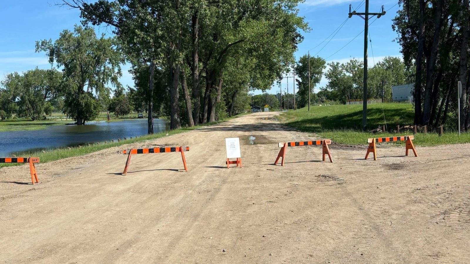
The City of Brandon has declared a state of local emergency as the Assiniboine River threatens to spill its banks following torrential rainfall across western Manitoba. River levels are forecast to rise dramatically, with peak water flows expected to strike between July 11 and July 14, forcing municipal leaders to rapidly fortify dikes to prevent widespread catastrophe. This proactive intervention underscores a structural vulnerability that continues to plague the Westman region despite years of infrastructure spending.
The emergency order gives local authorities the power to bypass standard procurement procedures and draft private contractors immediately. Crews are working to raise the existing dike infrastructure by 60 centimeters, providing a buffer against the incoming wave of water, high winds, and unpredictable river surges. For residents of Manitoba’s second-largest city, this is a cinematic rerun of a recurring nightmare. While provincial authorities frame the response as a model of modern engineering preparedness, a deeper look into the regional water basin reveals a system pushed to its absolute limits by shifts in weather patterns and historical land-use decisions.
The Geography of Vulnerability
Brandon sits in a natural geographic funnel. The Assiniboine River basin collects water from vast swaths of eastern Saskatchewan and western Manitoba, channeling millions of cubic meters of runoff directly past the city's northern flank. When heavy downpours hit the Parkland region and the Shellmouth River basin simultaneously, the entire system begins to back up.
Water levels are projected to crest at nearly 2.5 meters above the standard bankful capacity at Brandon's 18th Street gauge. To visualize the scale, consider a standard two-story home completely submerged up to its rooflines across the entire floodplain. The province’s Hydrologic Forecast Centre indicates that the river will swell to elevations between 1,182.7 and 1,184.1 feet. This is not quite the devastating apex of the historic 2011 flood, which saw the Assiniboine grow to twenty times its normal width, but it is uncomfortably close.
Municipal engineering works by a simple mathematical truth. Dikes are built to withstand statistical probabilities, not infinite water. When a regional system experiences successive, multi-day cloudbursts like the ones that recently battered Swan River and Dauphin, the ground loses all absorption capacity. The water has nowhere to go but down.
The Downstream Burden
Brandon does not suffer in a vacuum. The water currently threatening the city is the same volume that recently forced the evacuation of 200 homes in Swan River and crippled municipal services in Dauphin. As those northern communities begin the messy process of pumping out basements and clearing debris, the crest moves south and east.
The Little Saskatchewan River, which flows through Minnedosa, is similarly engorged, adding its volume to the broader Assiniboine system. Minnedosa itself declared a state of emergency as volunteer crews scrambled to fill thousands of sandbags to protect local properties. Further west, the Sioux Valley Dakota Nation has been forced into its own state of emergency, requesting urgent volunteer assistance to protect homes as floodwaters rise rapidly. This interconnected chain of crises highlights a stark reality. Every defensive measure taken upstream alters the speed and volume of the water arriving downstream.
The Limitations of Infrastructure
For decades, the standard response to prairie flooding has been to build higher walls. Brandon possesses a heavily engineered dike network that has been systematically reinforced since the disasters of 2011 and 2014. These earthen barriers are highly effective at keeping the river within a designated corridor, but they create a false sense of absolute security.
When a city relies exclusively on static dikes, it creates a high-stakes scenario. A single breach or low point can cause catastrophic, sudden inundation of commercial zones and residential pockets along the riverbank. This explains why Mayor Jeff Fawcett and the city council refused to gamble on the current forecast. The immediate deployment of clay to top up vulnerable sections of the dike near Grand Valley Road and Conservation Drive is an admission that the existing safety margins are paper-thin.
The city is also closing temporary dikes across major thoroughfares like Grand Valley Road west of 18th Street North. These actions disrupt commerce and cut off transit routes, showing that even a successful flood defense operation carries a steep economic price tag. The Riverbank Discovery Centre, a major community hub, finds itself on the front lines of the containment effort once again, with recreation fields and golf courses serving as intentional sacrificial buffers to save critical industrial and residential infrastructure.
The Shellmouth Dilemma
At the heart of western Manitoba’s flood management strategy is the Shellmouth Dam and Reservoir. Located further upstream near the Saskatchewan border, this massive structure is designed to catch peak flows and release them gradually, shielding downstream communities like Brandon and Winnipeg from sudden surges.
The dam is a balancing act. If provincial engineers hold back too much water early in the season, they risk overflowing the reservoir if a sudden summer deluge occurs. If they release too much water too early, they cause artificial flooding downstream before the natural spring runoff has cleared.
When extreme weather events occur outside of the traditional spring melt period, the management matrix shatters. The recent intense summer rainfall overwhelmed local soil capacities before the reservoir could be optimally positioned to absorb the shock. The result is an uncontrolled volume of water overtopping regional banks, proving that human engineering can only modulate, never fully control, the hydrology of the Canadian prairies.
The Economic and Human Cost of Perpetual Defense
Living under a permanent threat of flooding alters the psychology and economy of a municipality. While Brandon officials emphasize that there are currently no evacuation orders in place for the urban core, the economic toll is already accumulating.
| Location | Emergency Status | Primary Infrastructure Impact |
|---|---|---|
| Brandon | State of Local Emergency | Dike topping, major road closures at Grand Valley Road |
| Minnedosa | State of Local Emergency | Sandbagging along Little Saskatchewan River |
| Sioux Valley Dakota Nation | State of Local Emergency | Threat to residential properties, urgent need for sandbagging |
| Swan River | Recovering from Deluge | 200 households evacuated, significant infrastructure hazards remaining |
The financial burden of mobilizing heavy machinery, purchasing thousands of tons of clay, and deploying municipal staff on around-the-clock monitoring runs into hundreds of thousands of dollars per day. While provincial disaster financial assistance programs frequently step in to cover a portion of these costs after the fact, local tax bases bear the immediate cash-flow strain.
Private contractors who would otherwise be working on commercial developments, road repairs, or housing projects are diverted to emergency dike construction. This creates a hidden drag on the local economy, delaying vital infrastructure improvements elsewhere in the city.
The Volunteer Deficit
In smaller communities surrounding Brandon, the defense mechanism relies almost entirely on human muscle. The Sioux Valley Dakota Nation's urgent call for volunteer sandbaggers, stackers, and community cooks to support flood workers illustrates the fragile nature of rural flood defense.
Relying on spontaneous volunteer mobilization is a precarious strategy. As populations age and economic pressures force residents to work longer hours, the pool of available labor for emergency sandbagging is shrinking. A system that depends on citizens destroying their backs to lift fifty-pound bags of wet sand in the middle of a summer heatwave is a system ripe for failure.
Redefining the Flood Strategy
The current emergency in Brandon proves that the traditional playbook of reactive fortification is reaching its economic and physical limits. Climate data indicates that intense, localized summer rainstorms are becoming more frequent and severe across the Canadian plains. The historic patterns that engineers used to design the current dike heights are no longer reliable benchmarks.
To break the cycle of constant emergency declarations, provincial and municipal planners must look beyond the edge of the riverbank. This means shifting focus toward landscape-level water retention strategies.
Restoring Natural Buffers
Over the past century, vast areas of wetlands and natural grasslands across western Manitoba and eastern Saskatchewan have been drained to expand agricultural production. While this has significantly increased crop yields, it has systematically removed the region's natural sponges.
When a heavy rainstorm hits a tiled, well-drained agricultural field, the water is swept away into local ditches and creeks almost instantly. This rapid drainage accelerates the time it takes for a rainfall event to translate into a dangerous river crest at Brandon.
Restoring marginal agricultural land back into wetlands would allow the upper watershed to hold millions of gallons of water during peak rainfall events, slowing down the delivery of water to the Assiniboine River. This approach faces intense political resistance from agricultural groups who view wetland restoration as an attack on their livelihood, yet the alternative is the multi-million-dollar fortification of urban centers every few years.
Controlled Flow Diversions
Another alternative involves the creation of designated, compensable floodways that allow excess water to spill harmlessly over agricultural land rather than threatening urban infrastructure or First Nations communities. Manitoba already uses this strategy effectively with the Portage Diversion further downstream, which channels excess Assiniboine River water north into Lake Manitoba to protect Winnipeg.
Expanding this concept to western Manitoba would require significant capital investment and complex negotiations with landowners. It would mean paying farmers to allow their fields to store water during extreme events. While expensive, it offers a permanent, predictable safety valve that static earthen dikes can never provide.
The Immediate Horizon
For the next week, Brandon’s fate rests entirely on the integrity of its mud walls and the accuracy of provincial hydrographs. The Emergency Operations Centre remains fully activated, managing a complex logistical ballet of clay deliveries, structural inspections, and public safety alerts.
Residents have been instructed to stay away from the dike systems, closed pathways, and riverbank areas. The warning is driven by a stark reality. The sheer velocity of the water moving through the Assiniboine corridor creates immense pressure on the earthen walls, making the surrounding terrain unstable and prone to sudden slumping.
If the dikes hold at their newly elevated heights, Brandon will escape major structural damage, and politicians will praise the quick action of emergency crews. But as the water eventually recedes and the clay caps are removed, the fundamental question will remain unanswered. Western Manitoba cannot continue to sandbag its way out of a changing hydrological reality. The walls can only go so high before the river demands a completely different approach to the land it carves through.