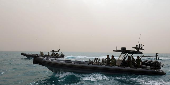
Salt crusts the edges of a steel railing at dawn while a diesel engine thrums beneath the floorboards. Out here, sixty miles south of Crete or north of Tobruk, the horizon looks unbroken. Blue meets blue. Yet on a chart glowing inside a wheelhouse, invisible straight lines slice through empty water like surgical scars.
Ratification. One word on a piece of paper in Tripoli or Ankara. Thousands of square miles of sea floor, gas pockets, and shipping lanes suddenly claimed, contested, or reordered.
I have stood on enough decks along the eastern Mediterranean to know how abstract diplomacy turns physical. You smell diesel and fried sardines at six in the morning. You feel the roll of a four-meter swell in your knees long after you step back onto concrete. When politicians sign or ratify a maritime boundary deal between Libya and Turkey, they rarely talk about the creak of a winch or the price of ice in a coastal port. They talk about sovereign rights, exclusive economic zones, and strategic depth.
Those phrases sound tidy inside a conference room. Out on the water, they are anything but tidy.
What a Line on a Chart Actually Does
To understand why Libya’s ratification of a maritime agreement with Turkey redraws regional lines, start with a simple analogy. Imagine two neighbors sharing a wide, quiet pasture with an orchard at one end. No fence exists, only an old creek bed. One day, two families draw a straight line across the middle of the grass with chalk, claiming ownership not just of the dirt beneath their boots, but of everything buried ten feet down and every path leading through the trees.
That is the rough shape of maritime delimitation, though the stakes are far heavier than pasture grass. Under international maritime law, coastal states claim territorial waters close to shore and an exclusive economic zone stretching up to two hundred nautical miles out, where they hold sovereign rights over natural resources like oil, gas, and fish.
When Libya and Turkey signed their maritime pact in 2019—and moved through the ratification steps that give such agreements formal legal weight in domestic and international arenas—they linked their coastlines across waters claimed or contested by neighboring states, especially Greece and Egypt. Because the agreement treats certain islands differently than mainland coasts or projects maritime zones across stretches of sea where other countries assert overlapping claims, it collides directly with rival maps.
A single line on a chart can turn calm water into a diplomatic tripwire.
Consider a hypothetical scenario to see how quickly paper becomes friction. Suppose a survey vessel operated by a regional energy company prepares to map seabed geology in an area where two maps overlap. One government views the coordinates as undisputed sovereign territory under a ratified bilateral pact. Another views the same box of water as an encroachment on its continental shelf. A patrol boat appears on the radar screen. Nothing has to fire for tension to spike; just holding station a few miles apart changes every calculation in nearby capitals.
Why a Divided Country Ratifies Anything
Here is where the story gets complicated, and where honesty matters more than neatness. Libya is not a single, unified choir singing from one sheet of music. For years, power has been fractured between rival administrations, competing armed factions, and shifting foreign backers.
When I try to untangle who speaks for Libya on a major treaty, I sometimes catch myself shaking my head at the sheer maze of factions, courts, and parliaments. It is confusing. It is uncertain. Anyone who claims to predict every twist of Libyan domestic politics with total certainty is selling confidence they do not have.
Even so, a clear pattern emerges when you look closely at why maritime agreements pull outside powers toward Libya. Geography puts Libya right at the hinge of North Africa and the eastern Mediterranean. Whoever holds influence in Tripoli or Benghazi—or secures formal recognition and energy partnerships there—gains leverage far beyond Libya’s own borders.
For Turkey, a pact with Libya anchors its vision of a broad maritime domain stretching from Anatolia toward North Africa, strengthening its hand in disputes over offshore gas exploration and sea lanes. For factions inside Libya, aligning with a major regional power brings political backing, security ties, economic promises, and a seat at a much larger table.
Ratification is never just a legal formality. It is a signal. It tells neighbors, rivals, and energy companies that one side is trying to lock facts on the water before negotiations—or pressures—can shift the balance elsewhere.
The People Living Inside the Coordinates
Let me introduce a hypothetical character, Tariq, a second-generation fisherman out of Misrata, to bring this down from diplomatic cables to calloused hands.
Tariq does not read maritime law journals over his morning tea. He reads cloud formations, wind shifts, and fuel gauges. Fuel costs money. Ice costs money. Every extra hour spent steaming around a restricted zone or avoiding a tense patrol eats into what he brings home at the end of the week.
When boundaries shift or naval patrols tighten in contested waters, small boats feel the squeeze first. Exclusion zones, sudden warnings over marine radio, or disputes between authorities can shrink safe fishing grounds or make crossings feel heavier with risk. Big energy consortiums have legal teams and armored support vessels; a wooden or fiberglass boat has a VHF radio and a tight margin.
And Tariq is not the only one standing near the edge of those lines. Merchant crews moving cargo between ports, port workers watching shipments rise or stall, and families in coastal towns whose livelihoods rise and fall with regional stability all live inside the ripple effects of high-stakes agreements.
Gas, Pride, and Old Grievances
Why do maritime lines get so heated in the eastern Mediterranean? Partly because of what lies beneath the waves—natural gas reserves and potential energy routes that could shape future supply lines—and partly because of something older and harder to measure.
History sits heavy on these waters. Empires rose and fell across these exact trade routes. Borders were drawn and redrawn by outside powers, wars, and treaties that left scars lasting generations. When a modern government draws or ratifies a maritime line today, it is rarely just talking about cubic meters of gas. It is talking about dignity, sovereignty, and who gets to set the rules in a neighborhood long shaped by outside intervention.
That is why a legal text can feel like a provocation to one capital and a triumph to another. Greece points to international law principles regarding islands and continental shelves; Egypt watches its eastern and northern maritime flanks closely; Turkey pushes back against efforts it sees as boxing it into narrow coastal waters; Libyan actors maneuver for survival and leverage amid deep internal division.
Everyone cites law. Everyone cites history. Meanwhile, the sea keeps rolling, indifferent to speeches.
What Happens When Maps Collide
When two overlapping maps meet on the same stretch of water, three things usually follow.
First comes diplomatic pushback. Neighboring states issue formal protests, submit counter-maps to international bodies, or sign rival agreements with other partners to build competing blocs. Every signature becomes a brick in a diplomatic wall.
Second comes naval posturing and surveillance. Even when governments want to avoid direct clash, showing the flag—sending a frigate, flying a reconnaissance aircraft, or escorting a research ship—is how states prove they take their lines seriously. Tension rises not necessarily because anyone wants a war, but because miscalculation becomes easier when ships operate close together in disputed waters.
Third comes investment hesitation. Energy companies and shipping insurers hate ambiguity. A disputed maritime boundary raises legal risks, financing costs, and political headaches. Projects stall, slow down, or shift elsewhere until the ground—or the water—feels less shaky.
Still, history shows that maritime disputes do not always end in deadlock forever. Countries have spent years arguing over coordinates only to eventually negotiate compromises, joint development zones, or quiet understandings when the cost of friction grows too high.
Standing on the Shore Tomorrow
Think about how quiet a map looks on a screen. Blue ocean. Thin colored lines. Neat labels.
Now think about a harbor at dusk when the wind picks up off the water. Cranes stand dark against an orange sky. A tugboat nudges a freighter toward a berth while small skiffs bob near the breakwater, their lanterns winking on one by one. Every boat out there carries someone’s rent, someone’s worry, someone’s hope for a calmer year than the last.
Ratifying a maritime deal between Libya and Turkey does not pour concrete into the sea or build a single pipeline overnight. What it does is harden a claim, sharpen a rivalry, and remind every capital around the basin that the eastern Mediterranean is a chessboard where nobody is moving a piece by accident.
Out past the harbor wall, the water stays dark and deep, holding every line drawn above it until the next wave rolls through.