Extreme precipitation events in the Himalayan watershed trigger a distinct class of multi-jurisdictional disasters that routine emergency frameworks fail to contain. When cloudbursts strike high-altitude terrain spanning Nepal and the Tibet Autonomous Region, the resulting flash floods operate on a compressed timeline of devastation. The core mechanism involves glacial lake outbursts and intense monsoon downpours funneled through steep, narrow river gorges. This converts standard rainfall metrics into high-velocity kinetic energy that strips topsoil, obliterates linear infrastructure, and isolates human settlements before warning systems can transmit data downstream.
Traditional reporting on these transboundary events relies on aggregate casualty counts and reactive descriptions of rescue operations. That approach obscures the structural failure points that govern loss of life and economic disruption. Evaluating these disasters requires dissecting the interaction between geomorphology, meteorological anomalies, and institutional response latency.
The Three Operational Phases of High-Altitude Flash Floods
The lifecycle of a Himalayan flash flood operates across three distinct operational phases, each demanding specific mitigation architectures that are rarely deployed concurrently.
The initiation phase centers on upper-catchment dynamics. Rapid thermal expansion in high-altitude environments melts seasonal snowpacks while simultaneously destabilizing moraine-dammed glacial lakes. When atmospheric pressure systems trap moisture against the southern slopes of the Himalayas, localized precipitation rates exceed soil saturation thresholds within hours. The primary variable here is not total rainfall volume, but intensity per square kilometer over a compressed temporal window.
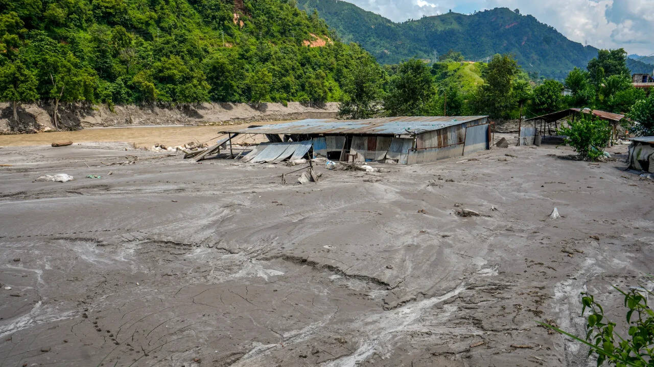
The propagation phase governs how the released volume travels through confined river valleys. As torrents scour steep canyons, they entrain sediment, boulders, and arboreal debris, transforming clear water into a high-density debris flow. This hyper-concentrated mass increases the bulk density of the flood wave, amplifying its momentum and destructive capacity. Infrastructure designed to withstand standard hydraulic pressure collapses instantly under the dynamic load of moving rock and mud.
The impact phase hits downstream valley bottoms where human settlements and trade corridors concentrate. Because valley floors offer the only viable terrain for roads and villages, population exposure is disproportionately high. The velocity of the arrival wave leaves virtually zero tactical window for horizontal evacuation, shifting survival probability entirely to vertical altitude positioning and pre-engineered structural resilience.
The Cost Function of Transboundary Information Asymmetry
Geography does not respect political boundaries, yet disaster response mechanisms remain strictly national. When flash floods originate in the Tibetan plateau and cascade southward into Nepalese river basins, downstream communities face a critical information deficit.
Hydrological data sharing across international borders is historically encumbered by bureaucratic friction and a lack of real-time telemetry integration. Without upstream stream-gauge telemetry and automated cloudburst detection sensors transmitting across the border, downstream agencies operate in a blind state. The economic and human cost function rises exponentially with every minute of communication delay.
A functioning early warning system must decouple data transmission from diplomatic channels. Automated acoustic sensors and pressure transducers placed in upper-tier glacial lakes can trigger downstream cellular broadcasts and sirens autonomously via satellite relays, bypassing human decision-making nodes that introduce latency during critical windows.
Infrastructure Vulnerability and Systemic Bottlenecks
The physical footprint of development in the Himalayan corridor routinely violates geological realities. Road networks, hydropower facilities, and residential zones are constructed on alluvial fans and active floodplains because alternative ridge-line routing is economically prohibitive.
Bridges spanning gorge-cut rivers are engineered to handle maximum historical water flow, not the cross-sectional area demands of a debris-laden hyper-flood. When a bridge acts as a temporary dam against accumulated timber and sediment, the resulting artificial lake breaches violently, multiplying the downstream surge wave.
Power generation infrastructure faces parallel vulnerabilities. Run-of-the-river hydroelectric projects, vital for regional energy grids, lack the structural isolation required to survive sediment burial. Intake structures become clogged, turbines are sheared by abrasive quartz silt, and transmission towers situated on eroding riverbanks collapse, severing the communication links needed to coordinate relief efforts.
Geopolitical and Logistical Constraints on Relief Operations
Deploying humanitarian resources into isolated Himalayan terrain exposes severe logistical bottlenecks. Mountainous topography limits heavy airlift capabilities, particularly during active meteorological events when zero-visibility conditions ground rotorcraft.
Surface access routes are simultaneously severed at multiple pinch points. A single flash flood event can destroy dozens of suspension bridges and wash out foundational road cuts along major trading arteries like the Arniko Highway or regional access tracks. This compartmentalizes the disaster zone into micro-regions that must rely entirely on pre-positioned local caches for survival during the critical first seventy-two hours.
External aid organizations frequently misallocate resources by focusing on macro-level logistics hubs rather than decentralized, community-owned cache networks. Helicopters and national military assets cannot be everywhere simultaneously; therefore, tactical survival depends on equipping high-risk communities with autonomous power generation, satellite communication links, and localized food and medical reserves that can sustain populations for up to two weeks of complete isolation.
Strategic Mitigation Framework
Mitigating future catastrophic loss in the Nepal-Tibet corridor requires abandoning static flood-line mapping in favor of dynamic risk modeling that accounts for climate-induced glacial retreat. Engineering standards must be revised to mandate sacrificial infrastructure design, where non-critical components are engineered to fail cleanly without triggering cascading structural blockages. Investment must pivot away from post-disaster reconstruction funds and toward automated, cross-border sensor arrays and community-level vertical evacuation platforms engineered to withstand high-velocity debris impacts.