Transboundary flood disasters rarely stem from meteorological anomalies alone. When catastrophic inundations cross the Himalayan frontier between China and Nepal, standard media narratives routinely attribute the damage entirely to intense monsoon precipitation or glacial lake outburst floods. This perspective obscures the operational mechanics of the river basins. Disasters of this scale represent structural failures of data sharing, hydraulic engineering limits, and cross-border risk governance. Analyzing these events requires examining the underlying hydrology, the economic toll on arterial trade routes, and the systemic deficiencies in early-warning architectures.
The Hydrological Vectors and Meteorological Triggers
Himalayan river systems operate under extreme altitudinal gradients, turning minor meteorological shifts into massive hydraulic surges within hours. The geographic interface between the Tibet Autonomous Region of China and Nepal features steep gorges, fragile geological formations, and narrow river corridors. When concentrated cloudbursts occur at high elevations, runoff velocity scales exponentially with the slope angle.
Standard rainfall metrics fail to capture the destructive capacity of these events because they omit sediment load dynamics. Himalayan floodwaters rarely consist of water alone. They carry a heavy suspension of silt, boulders, and pulverized rock, transforming normal river channels into high-density debris flows. This hyper-concentrated mass increases the bulk density of the fluid, escalating the impact pressure on downstream structures far beyond standard clear-water hydraulic calculations.
Furthermore, glacial lakes perched near the watershed divide present a persistent threat. When moraine dams fail due to internal seepage or seismic activity, millions of cubic meters of water enter narrow river valleys simultaneously. The resulting hydrograph shows an instantaneous vertical spike in discharge rather than a gradual rising limb. Existing river-gauging stations frequently wash away during the initial shockwave, blinding downstream emergency managers precisely when data input is most critical.
Infrastructure Vulnerability and Supply Chain Disruption
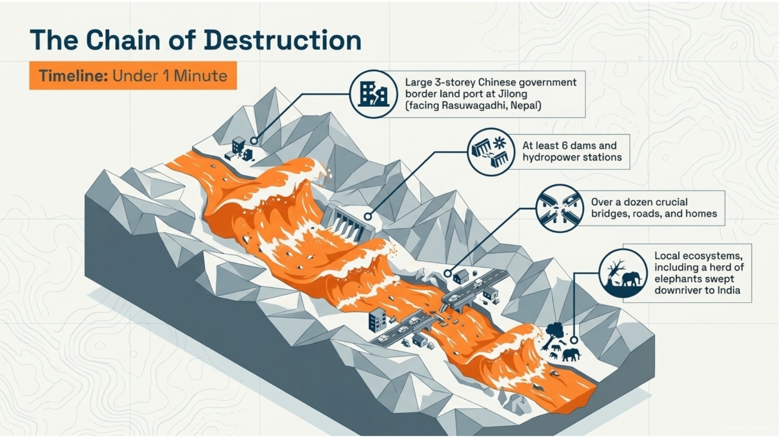
The economic impact of transboundary flooding concentrates heavily along transport corridors, specifically the trade routes connecting Tibet with Kathmandu. The Araniko Highway and the Rasuwagadhi-Kerung border crossing represent vital trade lifelines characterized by linear vulnerability. Road networks carved into unstable canyon walls face dual threats from riverbank scouring below and slope destabilization from heavy rain above.
When a river breaches its banks, the physical destruction of bridges and asphalt is merely the primary effect. The secondary effect involves extended supply chain fragmentation. Heavy cargo transit halts for weeks or months, stranding container traffic and forcing a complete rerouting of goods. The cost function of these disruptions includes:
- Capital loss from destroyed physical assets such as Bailey bridges, customs yards, and hydroelectric stations.
- Increased logistics costs as supply chains pivot to alternative, less efficient border entry points with lower freight capacity.
- Revenue loss for local enterprises dependent on cross-border commercial traffic and tourism.
Hydropower infrastructure in the region suffers from unique vulnerabilities. Run-of-the-river projects, which dominate the Himalayan energy landscape, rely on continuous water flow without large storage reservoirs. During high-sediment flood events, abrasive silt destroys turbine blades within hours unless intake gates close completely. Operators face a complex optimization problem: keep generating power until the intake chokes with debris, or shut down early and risk acute regional energy deficits. Many facilities lack automated, real-time sediment sensors capable of triggering protective shutdowns before particulate matter overwhelms the desandation basins.
The Governance Gap in Transboundary Early Warning Systems
Effective flood mitigation requires lead time, which in turn requires upstream hydrological data collection and rapid cross-border data transmission. The primary barrier to reducing human and economic casualties along the Nepal-China border lies in the institutional framework governing hydro-meteorological data sharing.
While bilateral diplomatic channels exist, real-time telemetry sharing between upstream Chinese agencies managing Tibetan river basins and downstream Nepali authorities remains inconsistent. Without continuous data feeds from high-altitude rain gauges and water level sensors located in Tibet, Nepali emergency responders operate reactively. They register a flood only when the surge hits downstream communities, rendering preventative evacuation protocols impossible.
Establishing a functional transboundary early-warning system requires overcoming three distinct hurdles:
- Technical interoperability: Integrating disparate telemetry standards, communication protocols, and data formats used by meteorological agencies in different jurisdictions.
- Institutional trust: Formalizing automated data exchange agreements that bypass bureaucratic bottlenecks during crisis events.
- Last-mile communication: Translating raw hydrologic telemetry into actionable evacuation orders delivered directly to vulnerable riverbank settlements via redundant communication channels.
Communities residing in the river valleys adapt to seasonal risks through historical precedent rather than scientific forecasting. However, climate change alters historical baselines. Frequency distributions of extreme precipitation events are shifting, rendering traditional local knowledge obsolete. A settlement built safely above a fifty-year flood line now faces inundation from twenty-year events due to accelerated snowmelt and altered monsoon jet streams.
Strategic Mitigation and Adaptation Pathways
Mitigating future disasters along the Nepal-China border requires shifting capital allocation from post-disaster reconstruction to preventive structural engineering and data integration. Rebuilding roads and bridges to pre-flood specifications guarantees repeated failure. Infrastructure investment must incorporate climate-resilient design principles, including wider bridge spans, deep-piled foundations anchored below scour depths, and real-time structural health monitoring sensors.
Land-use planning must enforce strict zoning laws that prohibit permanent commercial or residential structures within the active migration corridors of high-energy rivers. Where human settlement is unavoidable, decentralized community-level warning systems tied to upstream river level triggers can preserve life safety even when national-level data sharing lags.
The immediate operational priority involves the formalization of a joint hydrologic task force between Beijing and Kathmandu. This body must mandate open-source, real-time data telemetry across all major transboundary river basins, backed by redundant satellite communication links. By decoupling flood forecasting from diplomatic friction, both nations can convert uncoordinated emergency responses into an integrated risk-management framework.