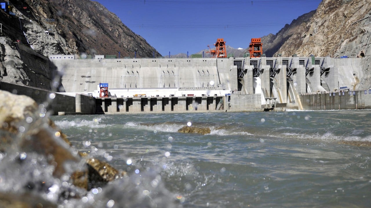
China is deploying facial recognition algorithms originally designed for human surveillance to monitor migrating fish in the Yarlung Tsangpo, Tibet’s largest and most ecologically volatile river. Conservation agencies and state-backed research institutes are attempting to track aquatic species through biometric profiling of individual fish faces, scales, and body patterns. The goal is to mitigate the catastrophic ecological fragmentation caused by massive upstream hydroelectric dam construction. But beneath the surface of this biometric push lies a web of strategic infrastructure expansion, geopolitical tension, and biological desperation.
Having spent decades covering environmental technology and state surveillance apparatuses, I view this development with profound skepticism. When authoritarian states apply mass-surveillance toolkits to natural ecosystems, the stated goal of ecological preservation rarely tells the whole story.
The Engineering Trap on the Yarlung Tsangpo
The Yarlung Tsangpo originates near Mount Kailash in western Tibet, cutting a dramatic path across the plateau before plunging into India as the Brahmaputra and eventually emptying into the Bay of Bengal. It is a wild, untamed artery. Or at least it was.
Beijing’s master plan for the lower reaches of the river involves mega-dam projects that dwarf the Three Gorges facility. These structures generate immense electrical power. They also act as insurmountable concrete walls for endemic migratory species like the Schizothoracinae, commonly known as snow trout, and various specialized carp species that rely on long-distance river connectivity for spawning.
Fish ladders do not work here. The sheer height of the planned dams—coupled with extreme seasonal water fluctuations and sediment loads—renders traditional engineering solutions useless.
Enter artificial intelligence.
Instead of modifying the dams to accommodate fish, engineers are installing high-definition underwater cameras, infrared sensors, and computer vision models at strategic bottlenecks. The software maps the unique morphological signatures of individual fish as they pass through narrow channels or specialized lift mechanisms.
Biometric tracking allows operators to log species, size, movement velocity, and population counts in real time. It is a monumental technical achievement. It is also an admission of failure. You only need to track fish with facial recognition when you have already destroyed their natural habitat to such an extent that artificial intervention is the only thing keeping them from local extinction.
How Biometric Fish Tracking Actually Works
To understand the mechanics, we must look past the press releases issued by state laboratories in Chengdu and Beijing.
Standard fish monitoring has historically relied on passive integrated transponder tags, acoustic telemetry, or manual netting surveys. These methods require physical capture, tagging, and recapture. They stress the animals, carry high mortality rates in turbulent high-altitude waters, and provide only a tiny sample size.
Computer vision changes the sampling scale. Cameras mounted inside fish passage facilities capture high-frame-rate video streams of passing fauna. Machine learning models, trained on tens of thousands of annotated images, isolate specific anatomical features.
- Ocular spacing: The precise distance between a fish's eyes.
- Operculum patterns: The unique bony flap covering the gills, which often features distinct scars, pigmentation spots, and striations.
- Scale geometry: Micro-variations in scale arrangement along the lateral line.
Once the algorithm matches these features against a database, the system determines whether a specific fish has passed through the checkpoint before. It automates the census.
Yet, water is a notoriously difficult medium for computer vision. Turbidity in the Yarlung Tsangpo spikes dramatically during the monsoon season and glacial melt periods. Suspended silt, organic debris, and rapid current shifts obscure camera lenses. Lighting conditions change wildly from bright alpine glare to pitch-black subterranean tunnels.
To compensate, engineers deploy active infrared illumination and multi-spectral imaging arrays. These systems demand continuous, high-capacity power sources in remote, hostile terrain. The infrastructure required to watch the fish requires its own localized energy grid, often tied directly into the very hydropower stations fragmenting the river in the first place.
The Geopolitical Undercurrent
We cannot separate the surveillance of Tibetan rivers from the geopolitical reality of downstream nations. India and Bangladesh watch every move Beijing makes on the Yarlung Tsangpo with acute anxiety.
Water is power. Control over the headwaters grants upstream nations strategic leverage over downstream populations numbering in the hundreds of millions. When India raises concerns about reduced dry-season flows or sudden artificial floods caused by dam operations, Beijing points to its environmental stewardship.
Deploying cutting-edge artificial intelligence to track fish populations serves a dual purpose for the Chinese state. Domestically, it satisfies urban, environmentally conscious middle-class citizens who demand proof that economic growth is not destroying natural treasures. Internationally, it functions as a public relations shield.
State media can broadcast high-resolution footage of algorithmic conservation efforts, projecting an image of hyper-modern ecological management. It frames the dam builders not as destroyers of pristine ecosystems, but as enlightened stewards utilizing advanced tech to harmonize industry with nature.
The reality on the ground is far messier.
The Limits of Algorithmic Conservation
Conservation biology is not merely a data-collection exercise. Knowing that a specific snow trout population has dropped by fourteen percent in a given reach does nothing to solve the underlying ecological crisis if the habitat itself remains fundamentally broken.
Fish need more than safe passage through a turbine intake. They need specific water temperatures, gravel beds for spawning, seasonal flood pulses to trigger reproductive behaviors, and uninterrupted nutrient flows.
A high-tech camera system cannot restore a thermal regime altered by a deep-reservoir dam. Cold water released from the bottom of a concrete wall kills downstream embryos adapted to sun-warmed alpine currents. Facial recognition software cannot recreate the sweeping braided channels of an untamed river that has now been converted into a series of stagnant, deep-water staircases.
Furthermore, relying on algorithmic management creates a false sense of security. Technocratic solutions encourage decision-makers to believe that any environmental degradation can be mitigated if the software is smart enough.
It is the silicon-valley fallacy applied to hydrology. If we just optimize the code, we can bypass the laws of biology.
We cannot. Evolution takes millions of years to shape a migratory species to a specific river basin. An AI model trained over three years in a laboratory tank cannot bridge that evolutionary chasm.
The Broader Surveillance Creep
There is another uncomfortable dimension to this story. The algorithms monitoring Tibetan river fauna are direct descendants of the systems deployed in urban centers across Xinjiang and major mainland cities.
The computer vision pipelines developed by firms like Hikvision and SenseTime—initially optimized for gait analysis, license plate reading, and facial tagging of citizens—find new life in ecological monitoring contracts. State subsidies flow freely into companies that can adapt dual-use surveillance software for environmental applications.
This creates a self-reinforcing industrial complex. Tech firms secure lucrative government grants to deploy advanced optical sensors across sensitive border regions and interior watersheds. The hardware network expands, creating a pervasive monitoring grid that watches everything moving through the landscape, human or animal alike.
In Tibet, a region characterized by intense security oversight and strict demographic control, the proliferation of high-resolution remote sensors along every major river valley adds another layer to an already dense surveillance apparatus. The cameras do not blink. They record flow rates, boat traffic, poachers, and migratory fish with equal indifference.
What Comes Next for the Plateau
As climate change accelerates glacial retreat across the Third Pole, the hydrology of the Yarlung Tsangpo will become even more erratic. Glacial lakes will burst, flash floods will scour valleys, and base flows will fluctuate wildly.
The state will lean harder into automated management. When human operators cannot reach remote high-altitude facilities during extreme weather events, autonomous systems will take over the sluice gates, the fish lifts, and the monitoring arrays.
We are witnessing the complete technocratization of nature. Every cubic meter of water measured, every migrating fish tagged by an algorithm, and every watt of hydroelectricity squeezed from the plateau represents a further retreat from wild ecosystems toward managed industrial aquariums.
The fish continue their journey upstream, driven by millions of years of genetic instinct, swimming past lenses that log their faces while concrete monoliths loom ahead, blocking the path forward.


