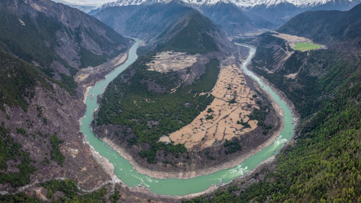
Building the largest hydropower project in human history directly over a major, active tectonic fracture sounds like a bad movie plot. But it's exactly what's happening right now in the fragile highlands of Tibet. China is moving ahead with its massive $147 billion dam system on the Yarlung Tsangpo—the river that eventually crosses into India as the mighty Brahmaputra.
Geologists backed by Beijing's own government just published a paper that should terrify anyone living downstream. They found that the project sits right on top of the Paizhen Fault, a fracture in the Earth's crust that has been active since the Ice Age. The rock underneath is already shattered, loose, and losing its structural integrity.
This isn't just an engineering headache for the China Yajiang Group, the state-owned entity running the show. It's a looming geopolitical nightmare for India and Bangladesh. If you want to know why this project matters, look at the map. The dam is going up in Medog County, right where the river takes a sharp U-turn before slamming into India's northeastern states. If this thing fails, a wall of water will decimate millions of lives in Arunachal Pradesh and Assam.
The Ice Age Fault That Never Slept
Let's look at the science because the details are pretty damning. The study was published in the Chinese-language journal Sedimentary Geology and Tethyan Geology. It wasn't written by Western critics; it came from scientists at the Chengdu University of Technology and the Civil-Military Integration Centre of the China Geological Survey.
They found that the Paizhen Fault runs right through the reservoir and construction zone. This fault isn't ancient history. While it dates back to the Pleistocene epoch, sediment analysis shows it moved as recently as 9,500 years ago. In geological terms, that's yesterday.
Even worse, the area is plagued by modern seismic activity. The researchers pointed to a magnitude 6.9 earthquake that hit Milin, Tibet, in 2017 as absolute proof that this ground is still moving. The Indian and Eurasian tectonic plates are constantly crashing into each other here. It's one of the most unstable mountain ranges on the planet.
Why the Ground Is Failing
The geologists didn't hold back in their assessment of the local terrain. They noted several major flaws in the rock structure:
- Fractured bedrock: Decades of fault activity have smashed the underlying stone, reducing its capacity to hold massive weight.
- Weak cohesion: The soil and rock along the canyon walls are loose and crumble easily.
- Saturation danger: Once the reservoir fills, water will soak into these weak slopes, making massive landslides practically inevitable.
Basically, you're putting a massive concrete plug into a crumbling canyon and filling it with billions of tons of water.
Why This Project Dwarfs the Three Gorges Dam
To understand the scale of what China is trying to do, you have to look at the numbers. This project is designed to generate roughly 300 billion kilowatt-hours of electricity every single year. That's about three times the capacity of the Three Gorges Dam, which is currently the biggest power station on Earth.
The geography of the Great Bend makes this possible. The river drops thousands of feet in a short distance. Engineers plan to tap into this crazy drop by drilling massive 12-mile tunnels to pipe water directly into underground turbines.
But that immense power comes with unimaginable risk. The Three Gorges Dam faced plenty of criticism for environmental damage and landslides, but it wasn't built directly over an active, grinding Himalayan fault line like this one.
The Downstream Nightmare for India and Bangladesh
India isn't taking this lightly. New Delhi has already placed the project under round-the-clock surveillance using satellite tracking and sensor networks along the Line of Actual Control.
The fear isn't just a sudden, catastrophic structural failure. There's a deeper geopolitical game at play here. The Brahmaputra sustains the entire economy of Northeast India and Bangladesh, feeding agriculture, fisheries, and drinking water systems.
If China controls the tap on a dam that's structurally vulnerable, they get a perfect geopolitical excuse. Need to dry up the river during a political dispute? Just claim you're doing "emergency repairs" on the fractured fault line. Want to release a massive flash flood to disrupt Indian border infrastructure? Oops, it was just an unexpected landslide causing an emergency spillway release.
Erosion is another massive issue. The canyon where China is building currently provides around 45% of the total sediment that flows downstream. Block that silt, and agriculture in places like Assam and Bangladesh takes a massive hit. The soil will lose its natural fertility over time.
What Happens Next
Beijing says the dam is purely for green energy and won't hurt the water flow to its neighbors. But the fact that their own state-funded scientists are waving red flags proves that the engineering challenges are spiraling out of control.
If you're tracking regional security or environmental policy in Asia, watch how China handles these geological warnings. They can't rewrite the laws of physics. They'll either have to spend billions more on massive slope reinforcements and retaining walls, or risk building a multi-billion-dollar ticking time bomb at the roof of the world. Expect India to ramp up its own defensive infrastructure and counter-dam projects in Arunachal Pradesh as a direct response to this threat.