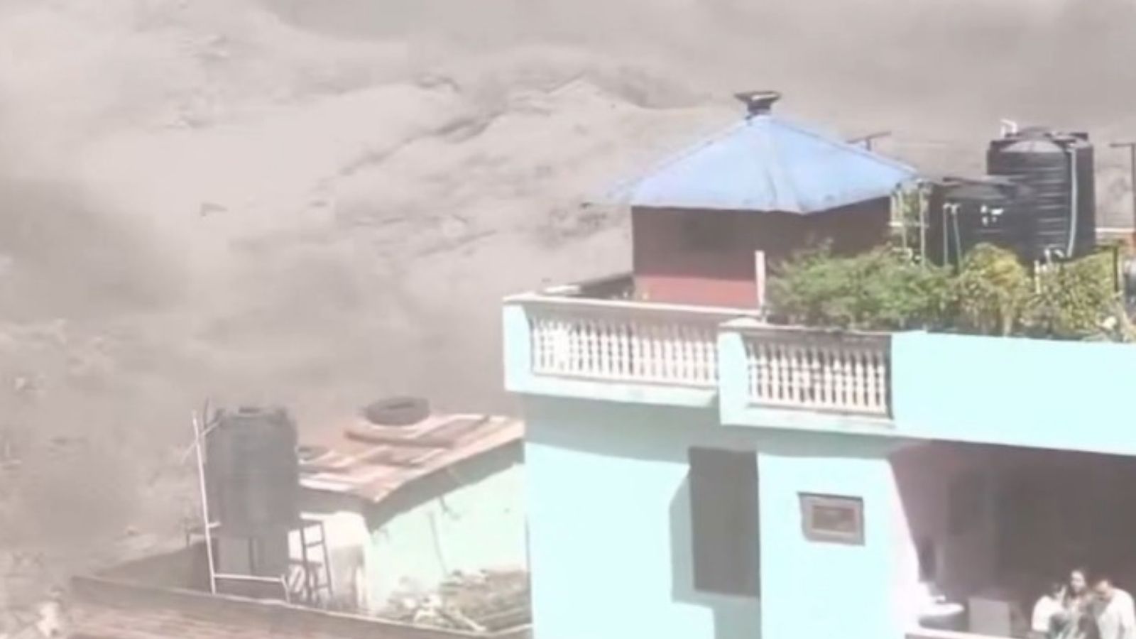
The narrative following the catastrophe on the Nepal-Tibet border is dangerously uniform. A glacier collapses, a barrier lake forms, panic ensues, and media outlets automatically default to a predictable script about global heating. Everyone nods solemnly, prints the standard talking points about a warming planet, and prepares to wait for the next inevitable tragedy.
It is a comforting routine. It allows regional governments, infrastructure planners, and international bodies to hide behind macro-level abstractions. If an entire disaster is reduced to ambient atmospheric changes, nobody has to answer for local failures.
Let us dismantle this lazy consensus. The recent disaster where a 2.5-million-cubic-metre barrier lake overflowed into the Bhotekoshi-Trishuli river system, killing hundreds and leaving thousands missing, is not merely a weather story. It is an engineering, planning, and geopolitical governance failure. Pinning the blame entirely on rising temperatures ignores the physics of high-altitude debris flows and lets corrupt development practices off the hook.
The Geography of Deception
To understand why the standard reporting misses the mark, look closely at how these barrier lakes form. When a massive chunk of ice and rock breaks loose from a 5,000-metre high ridge and plummets vertically, it generates an immense kinetic shock. The resulting slurry of mud, boulders, and ice acts like a bulldozer, carving valleys and depositing immense natural dams across narrow gorges.
Media reports treat these barrier lakes as ticking time bombs created exclusively by gradual glacial retreat. That is false. Sudden mechanical failures of sheer mountain faces—often exacerbated by seismic micro-faults and unmonitored local civil engineering—trigger these events instantly.
Imagine a scenario where every government body stops treating high-mountain hydrology as a stationary science and starts managing river corridors as active, high-energy industrial zones. Right now, trans-boundary communication between China and Nepal during a crisis resembles a game of postal chess. Rescuers on the ground are told a dam has burst only after satellite telemetry and local frantic phone calls confirm the worst. That is an institutional lag, not a meteorological inevitability.
The Flawed Fixes We Keep Funding
Local authorities love to talk about early warning systems and sensor arrays. Millions in international aid flow into installing automated sirens and river-gauging stations along vulnerable banks.
These measures give a false sense of security. Sirens do not stop nine-metre wall surges. When a debris flow travels down a steep Himalayan gradient at highway speeds, a sensor reading a water-level spike gives downstream residents minutes—sometimes seconds—to run. In the Rasuwa and Nuwakot districts, survivors sprinted for the hills with mere moments to spare.
Relying on downstream flight rather than upstream stabilization is active negligence. If engineering teams know that narrow river bottlenecks are prone to blockage by seasonal landslides, why are critical infrastructure projects, roads, and hydropower plants still permitted directly within high-risk dynamic flood channels? The rush to monetize Himalayan water resources through unyielding concrete installations ignores the basic reality of alpine geomorphology. Rivers in this region are not static supply lines; they are moving geological conveyor belts.
Real Data Over Rhetoric
Geomorphologists studying the Hindu Kush Himalayan region point out a distinct factor that casual commentators gloss over: sediment loading. When a flood bulks up with millions of tons of pulverized rock, its density changes entirely. It behaves less like flowing water and more like wet concrete.
Concrete does not obey standard river models. It chokes channels, raises riverbeds above the surrounding floodplains, and creates erratic secondary overflow vectors. When the barrier lake in Tibet breached its initial volume threshold, the downstream hazard multiplied because the riverbeds were already choked with residual debris from the initial Wednesday collapse.
Blaming global temperature anomalies for a localized sediment-bulked debris torrent is like blaming global economics when a poorly built bridge collapses under heavy traffic. Climate creates the baseline volatility, but human geography writes the casualty list.
What Practical Mitigation Looks Like
If we want to stop treating these border valleys as human shooting galleries, the approach requires radical overhaul:
- Mandatory Alpine Zoning: Halt all permanent commercial construction, tourism hubs, and hydropower installations within defined high-energy kinetic hazard corridors, regardless of economic potential.
- Active Reservoir Siphoning: Treat newly formed barrier lakes as immediate emergency engineering targets. Instead of waiting for natural overflows or catastrophic dam breaks, deploy heavy-lift drone infrastructure and modular siphons within hours of formation to bleed off volume safely.
- Bilateral Real-Time Data Sovereignty: Remove the bureaucratic friction between upstream and downstream nations. Tibet and Nepal share a hydrological ecosystem; intelligence regarding glacial destabilization and upper-valley seismic shifts must flow instantly, bypassing standard diplomatic clearance channels.
Stop waiting for the next climate summit to solve a problem that requires an excavator, a dynamite charge, and an honest zoning commissioner today.